I fell on my death bed after 40 effing hours. Smooched in the dark and slipped across the narrow gate of utopia. Stood in long queue but the ticket towards heaven was expensive enough to feel cumbersome my pocket. I found it fishy, hung my neck towards the signboard. It said ‘Hell Station’ -_-
On the contrary, I moved to the other foggy place and the place looked scary and very helliffic. A lot of fire with a protocol dire. Capitalism of jumping the grave was persisted. The hardest route was cleared, then a moment of surprise. A peaceful land with visibly 7 gates of heaven. To my dismay, no dead man walking towards the gate. I was the only to enter the gate as compared to a long queue at Hell Station. A golden escalator took me to the virgins.
Yeah I dreamed a dream. You can take me as Robert Plant of Led Zeppelin singing ‘Stairway to Heaven’ or you can make me Tom cat from Tom & Jerry’s 1949 episode ‘Heavenly Puss’ but that was me. Enough of romance on the clouds, my eyes ope very early morning as the morning prayers of Fajr were offered in all masjids. I was fully dressed like I was the whole past day and even shoed. I was back to normality after unusual heavy exhaustion.
The coast is clear with nothing to bear. I am back on my feet and very fit now but alas Lionel Messi is yet to clear his fitness. I slept again and this time, woke up at 10 am. The plan of moving our ass early morning heavily failed. All woke up late. Time to bath and geyser is about to mess with you. Mr. geyser had an unusual habit of delivering hot and cold water at its wish. I literally had to wait a couple of minutes for a normal water.

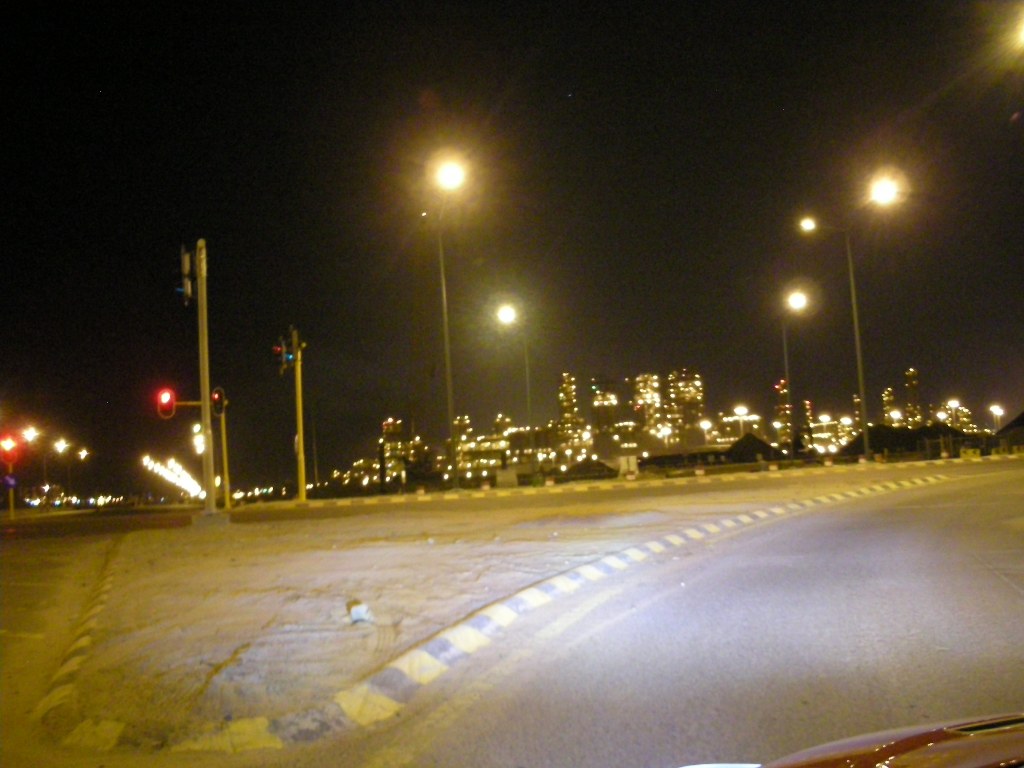
Bags were packed, and we were checking out from hotel. Outside hotel, the place was like a curfew. This city is not wild like Jeddah. But I did see couple of boys in street having fun. One boy who wore Real Madrid jersey was chasing a boy who wore Barcelona one lol. Keep chasing!!
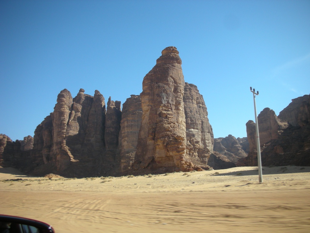
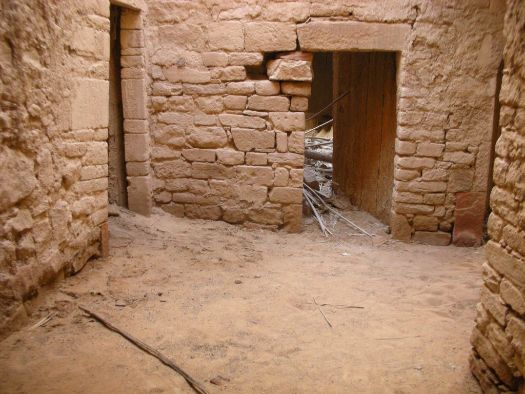
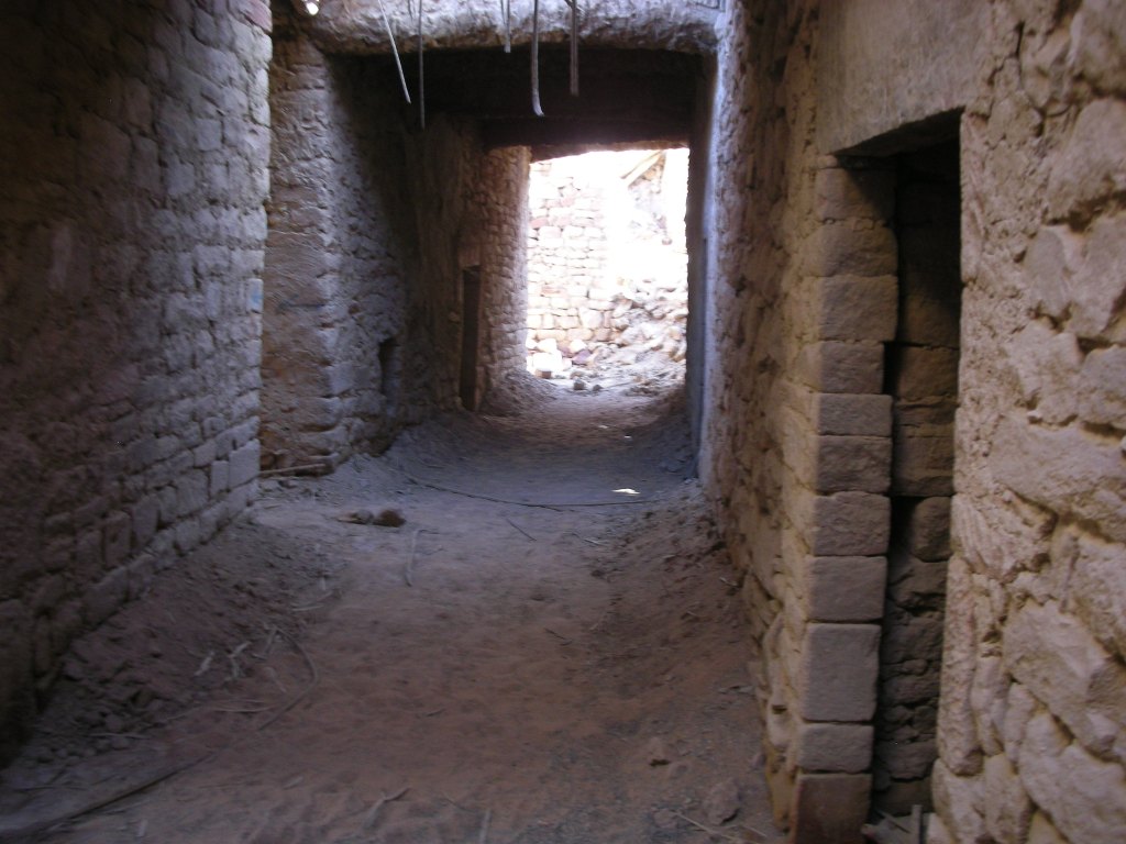
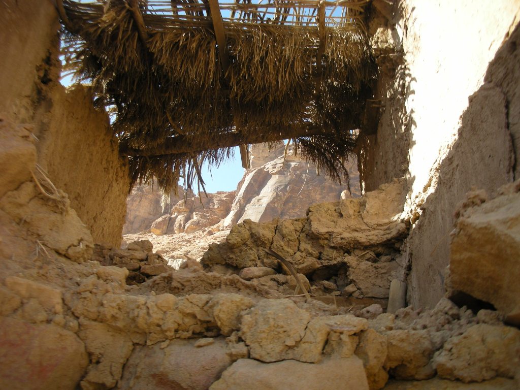
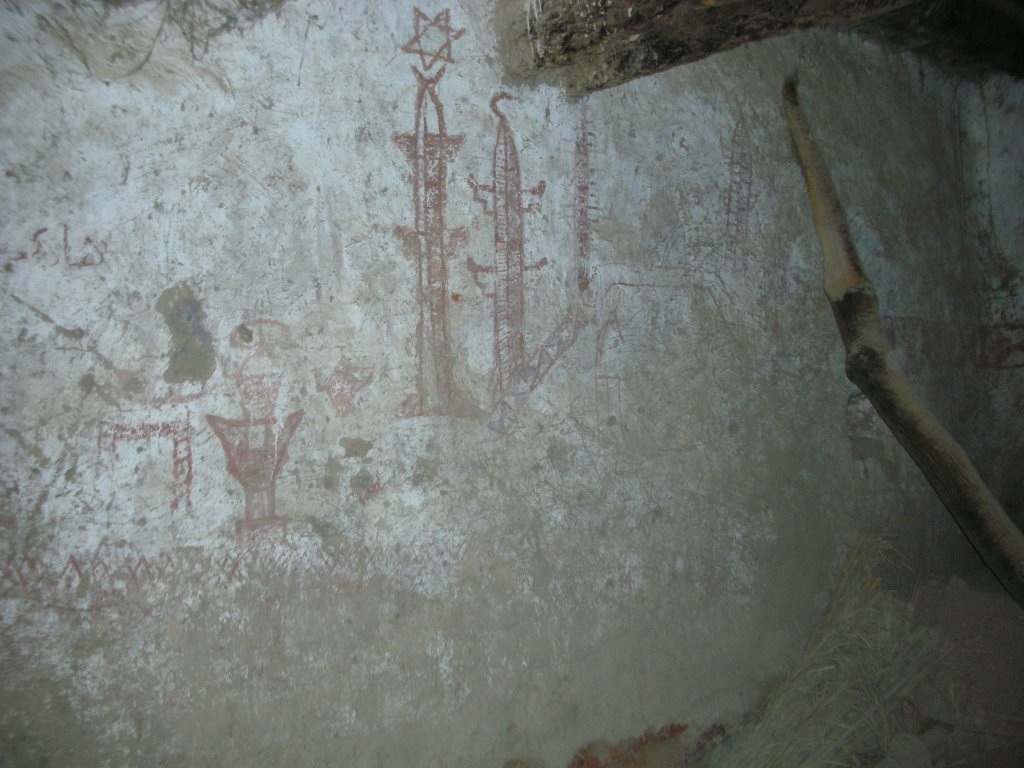
Our first target was to finish few of historic sites before we move to Madain Saleh. But the problem was that the routes were not understood well. We searched on the websites, but we didn’t find a proper route towards the sites which became difficult to locate. I slowed my car and flamingoed our necks on the main road left and right. Reached the district of Dedan where we were going to locate a very historical site of Al-Khuraybah. To our absolute bad luck, the place was neither opened nor the visiting times were written on the site information board.
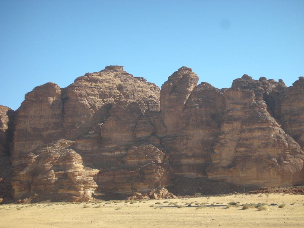
So what is al-Khuraybah? It is an archaeological city of Dedan located in the eastern part of Salamiya Farms and north-east of al-Ula. The history of the site can be traced back more than 2500 years ago. It represents the remains of the ancient city of Dedan between the two mountains. Like I wrote in the 1st chapter of ‘The Breezing Ula’ of my blog before, the Kingdoms of Lihyanites (Lihyans) and Dedanites (Dedan) were the two who ruled the city as Lihyans were the original settlers to al-Ula. And this city was the capital of Kingdoms of Dedan and Lihyan from 6th to 2nd century B.C. This site of al-Khuraybah fell under the same Kingdoms timeline wise.

Inside al-Khuraybah are further more sites which I found worth exploring but our fate that the gate was closed don’t know why. One is the Lions Tomb carved by the Lihyanites in the 6th century B.C. The numerous tombs are mostly plain burial chambers carved into the rock, but a small number of them have lion sculptures above them.
The next site was to search Umm Daraj. Umm Daraj means ‘Mother of Steps’. It is located in the Western part of al-Ula on Harrat Uwayrid or al-Harra mountain. You have to climb on this dangerous adventure to witness an ancient Lihyanite temple, inscriptions and petroglyphs. The location was very complicated and we unfortunately could not locate the exact spot. The time was speaking a lot and was getting very limited to complete ‘Madain Saleh’. So we just gave up and moved for the trip’s biggest target.
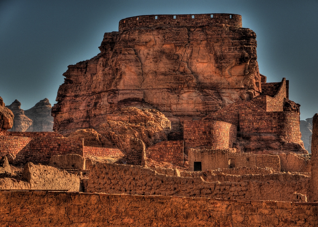
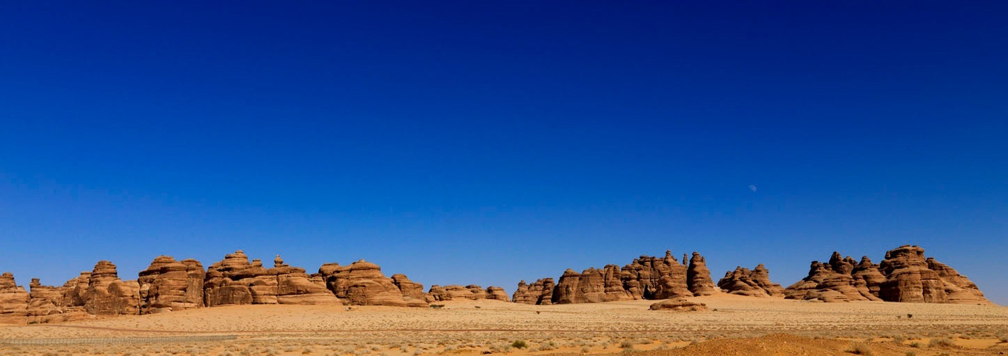
Madain Saleh!! The first site of the Kingdom of Saudi Arabia to be registered as ‘World Heritage Site’ by UNESCO (United Nation Educational, Scientific and Cultural Organization) in 2008. Madain Saleh ‘Cities of Saleh’ was coined by an Andalusian traveler in 1336 CE. It was back in 1880s when Charles Doughty became the first European to visit Madain Saleh.
For more details, click here http://whc.unesco.org/en/list/1293
Time schedule of visiting the site has been shorted by an hour due to early sunset. Opens at same 9am but now the gates are closed by 5pm instead of 6pm. On Fridays, the visiting hours further reduces to 3pm-5pm. Plus there are no lights there due to the fact of its being a cursed place. Why cursed place? I’ll explain later. The temperature was 19 degree Celsius. Enter the gate and I see some beautiful architecture of buildings. Toilet units are installed for both males and females. This is the very site, by knowing it my traveling hobby was born. My 3rd attempt to finish the exploration of this site is same like José Mourinho returning to Chelsea football club for the unfinished business. The place is a landmark of history itself where Nabatean Kingdom ruled from 168 BCE – CE 106.
THE KINGDOM AND ERA OF NABATEA (168 BCE – CE 106)
Who were Nabateans and their Kingdom?? Once former president and CEO of Saudi Aramco, Thomas C. Barger, wrote an article on Sep-Oct print edition of Saudi Aramco World back in 1965 about Nabateans. He stated, “In 312 B.C., about 10 years after the death of Alexander the Great, a Greek general who had served with Alexander led an expedition against a city called Petra in what is now Jordan. He captured the main fortress, looted it and retired with the city’s treasure. As he retreated, however, the defenders of the city counterattacked, in an unexpected night raid, massacred the Greeks and recaptured the treasure. The defenders were called Nabateans and this was their first appearance in recorded history.” For further readings of this article, kindly click here:
http://www.saudiaramcoworld.com/issue/196505/notes.on.the.nabateans.htm
According to historians, the Nabatean Kingdom at its peak stretched from modern-day Yemen to Damascus and from western Iraq into the Sinai Desert. The capital of this Kingdom was Petra, the ancient city of Jordan. Other cities besides Madain Saleh and Petra, which were ruled under this Kingdom were Bosra (a town in Southern Syria was the first Nabatean city in the 2nd century BCE) and Nizana (ancient city in Israel close to the Egyptian border).
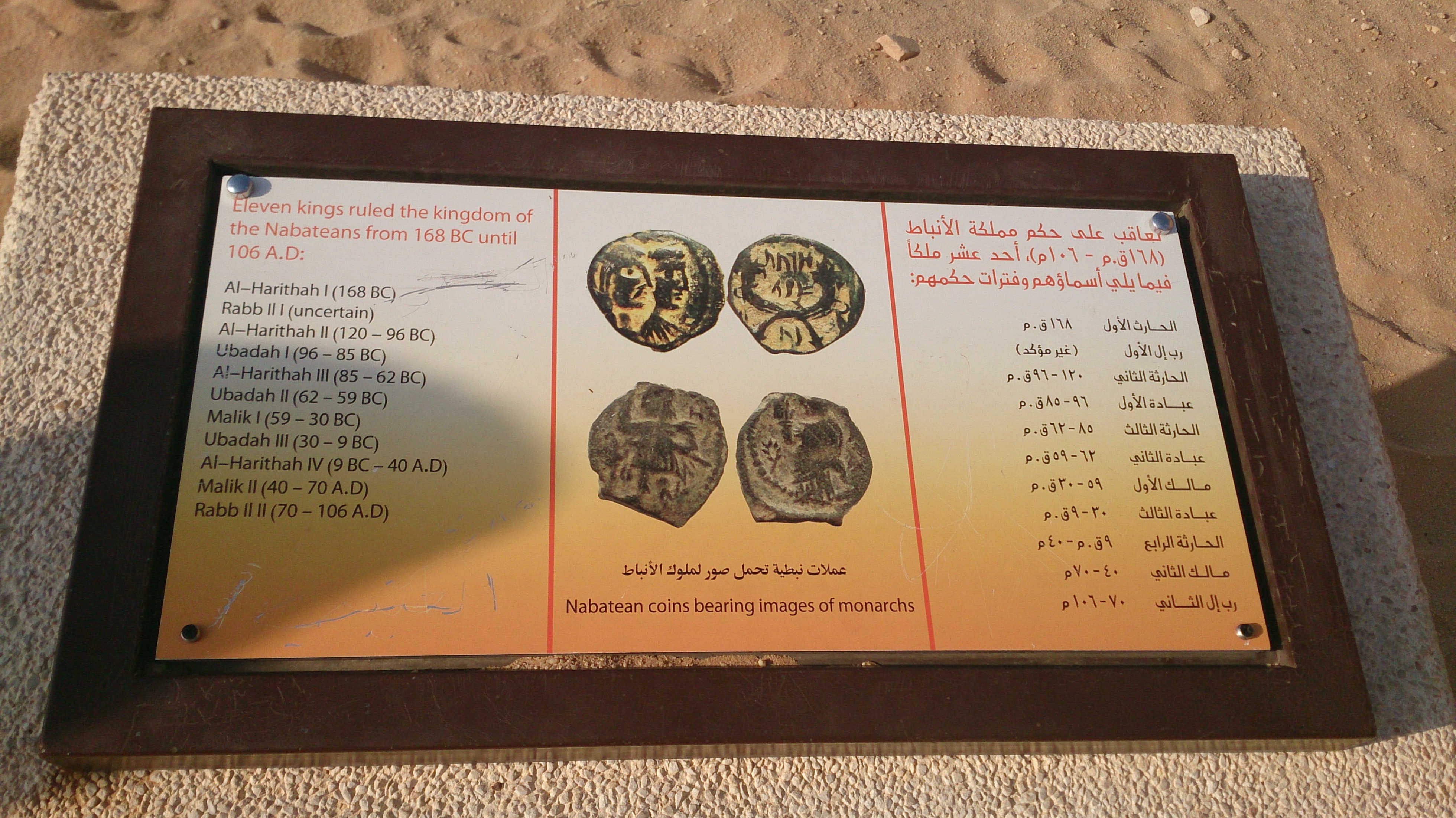
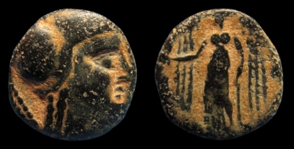
In total, 11 Kings ruled the Nabatean Kingdom in period of 274 years (168 BCE – CE 106). It all began from King Aretas I (al-Harithas in Arabic). Now the most interesting fact I researched about Aretas I which will surprise the readers is that his name was found on the oldest inscription of Nabatean in Haluza and Haluza is in Negev, the desert area of Israel. Haluza is known to be the most potential place where the Biblical city of Ziklag is predictably present and Ziklag is the place, where the Judas kingdom ruled.
Successor of the first King was King Rabbel I, but for how long? It is uncertain. The next King was Aretas II who ruled the kingdom for 24 years from 120 BCE till 96 BCE. Nabatean minting of coins began under him. He belonged to almost the same ruling timeline when Judea was ruled by Alexander Jannaeus under the Hasmonean Dynasty. Jannaeus seiged Gaza in 99 BCE but Aretas II failed to help the Gazans despite the fact of asking for help. Gaza was destroyed and lost.
Rivalry between the Nabateans and Hasmoneans continued. Three years after the loss of Gaza, entered Aretas II’s son Ubadah I. Ubadah I took revenge from the Hasmoneans and defeated them in 93 BCE on the Golan Heights. 8 years later, Nabatea was invaded by Antiochus XII Dionysus, one of the last ruler of Seleucid Empire (an empire founded and built by Seleucus I Nicator in 306 BCE, who was infantry general of Alexander the Great). The battle was fought between Ubadah I and Dionysus. As result, both were killed but invaders were defeated and the Nabatean Kingdom was somehow saved.
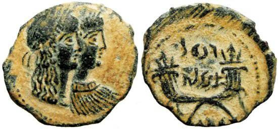
In came Aretas III, Ubadah I’s brother, who ruled the kingdom for next 23 years till 62 BCE. He was the most powerful of all Aretas and a revolutionary to the Kingdom. His biggest achievement was taking on Damascus which worked as a commercial trading route between Mediterranean Sea, India and the Middle-East. First silver Nabatean coins were produced under him. He strengthened Nabatean culture by introducing the architectural style of the Greeks and Romans in their capital of Petra.
Next was Ubadah II who ruled for merely three years. His son Malichus I (Malik in Arabic) came who ruled the kingdom for next 29 years from 59 BCE till 30 BCE. In 40 BCE he helped the Parthians overrun Syria and Palestine. After the Romans expelled the Parthians in 34 BCE, they confiscated Malichus’s date groves around Jericho and his Red Sea harbors. Herod also fought Malichus, defeating his army near Philadelphia (present-day Amman).
The eighth Nabatean King was Ubadah III, son of Malichus I. It was during his days that the Romans attempted to discover the sources of the perfume and spice trade. He ruled the next 21 years.
King Aretas IV was the ninth king who enjoyed the longest reign of 49 years over the kingdom. Aretas’ daughter married Herod Antipas, tetrarch of the Galilee. When Antipas took another wife, Herodias, Aretas’ daughter returned to her father, who went to war against the Jewish tetrarch and defeated him. Antipas appealed to Emperor Tiberius, who dispatched the governor of Syria to attack Aretas. The episode was an important factor in the beheading of John the Baptist.

The tenth king was Aretas IV’s son, Malichus II who ruled the Nabatea for the next 3 decades. This was the era when downfall began and lost Damascus. The Romans changed the spice and perfume trading route from the Nabateans to Egypt.
The last king was an absolute failure to his kingdom. Rabbel II was Malichus II’s son who was made sit on throne as child. So his mother took charge of running the government whereas his daughter became the Queen of the Nabateans. Rabbel died in 106 CE and the most powerful and successful Roman Emperor, Trajan, took an advantage of his death and annexed the Nabatean Kingdom and incorporated it into new Roman province of Arabia Petraea. Bosra was made the new capital.
PROPHET SALEH AND THAMUD CIVILIZATION
As I mentioned before that this site is widely accepted as a curse place. Allow me to present you the history behind it. This blog may lose its prominence of educating to the readers about Madain Saleh without speaking about the pre-Islamic history over this place.
It was somewhere in the 3rd millennium BCE. The ‘Aad civilization of Prophet Hud (alayhi as-salām)’s time was destructed by a thunderous storm from Allah Almighty [http://quran.com/46/24-25] after the prophet had sent them the message to worship Allah instead of worshiping idols and ask for forgiveness but they rejected [http://quran.com/11/50-57].
Entered the Thamud civilization who followed the footsteps of their predecessors. This civilization was very powerful in architectural skills as they carved mountains to build huge mansions and castles. The greater the civilization, the greater disobedience towards Allah and they worshiped almost 50 idols.
Prophet Saleh (alayhi as-salām) appeared as Prophet with Allah’s message to obey Him and ask for forgiveness. The King or people of Thamud ask for a sign or miracle to convince that he was the Messenger of Allah. The prophet asked their wish and they demanded to produce a camel from a mountain. The prophet prayed to Allah and the miracle happened when all of a sudden, the she-camel revealed from the mountain. The Thamudis were stunned. The prophet confirmed them that he has fulfilled their wish and the she-camel is now their guest. He added that the she-camel will drink water from well and no one will touch her with an evil intention.
For few days, the Thamudis tolerated the guest but couldn’t last long. Few of them planned to kill the guest. They hamstrung the innocent creature and gruesomely slew her. The calf born from the killing of its mother ran back to the same mountain with a loud screaming. The news of killing reached to the prophet and warned/prophesized the Thamudis of a severe wrath to appear on them in upcoming three days. They paid a huge price.
It is said that on first day, their faces went pale. The next day, it turned red and on the day of destruction, they were black. The Prophet Saleh and the believers left the city as their souls leaving their lifeless bodies in the midst of an disaster stuck via sound wave. A huge explosion took place in the night at dawn, which was followed by a horrifying earthquake. The civilization was dead.
The story is recorded in the Holy Quran and mentioned at many places. [http://quran.com/7/70-90] [http://quran.com/11/61-68] [http://quran.com/15/80-84] [http://quran.com/26/141-159] [http://quran.com/27/45-53]
For more details about Thamud, check http://www.madainsaleh.net/Thamud_Tribe.html
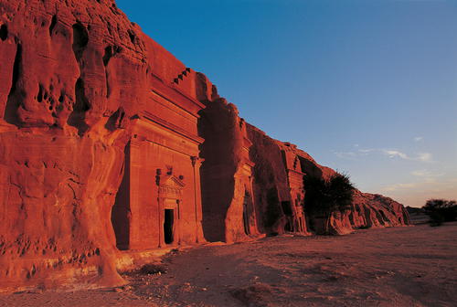
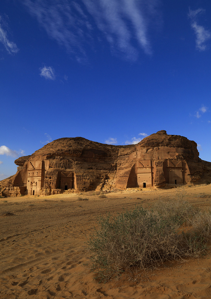
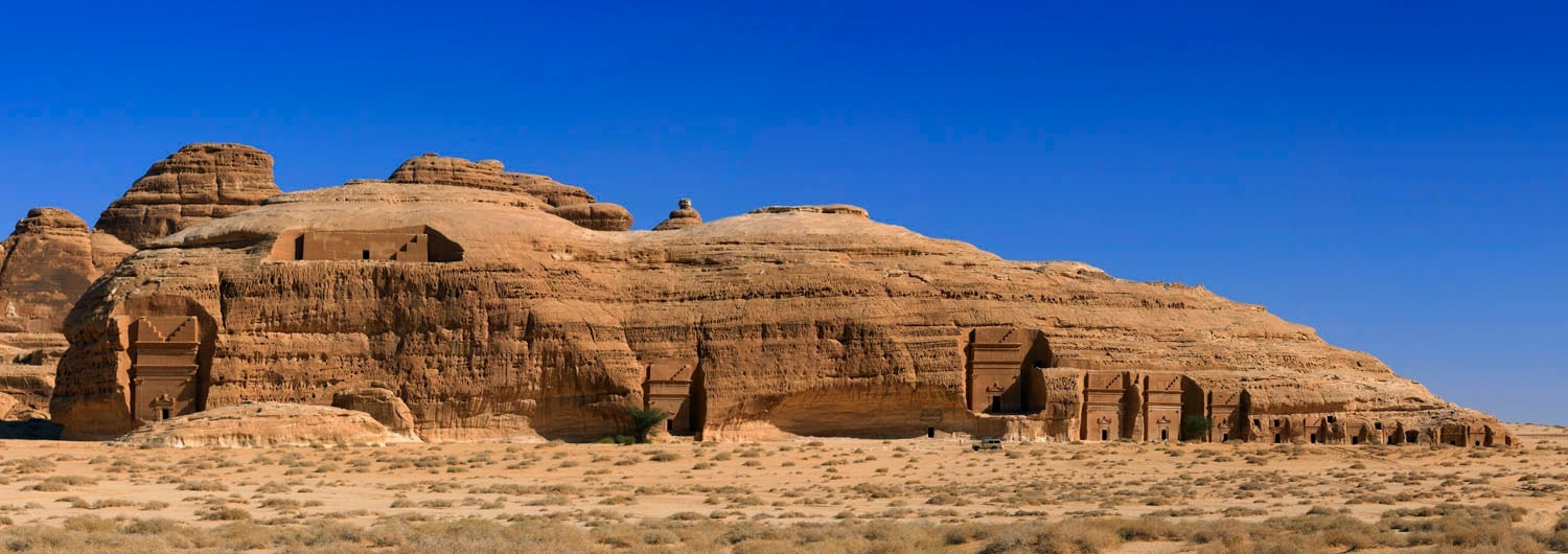
Madain Saleh is also called al-Hijr in Arabic whereas the old inhabitants of Thamud and Nabatea called the place ‘Hegra’. The place was the second largest settlement of the Nabateans after Petra. You will see a large amount of diverse and multifaceted monuments and necropolis. The site is spreading around 13km.
Sign boards on the paves and description boxes are presented for all the face hangers of the visiting cars written in both English and Arabic.
CLASSIFICATION OF TOMBS AND NECROPOLIS IN REGIONS
Around 130 rock-cut tombs of the Kings and people of Nabateans can be found. 45 of them carry Aramaic inscriptions outside the doors. These inscriptions detail the period of tomb’s constructions and for whom it was built. For furthermore easy access; the teams that have been working on this world heritage site, have grouped the total of tombs into various names. Let me try to distinguish the places of Madain Saleh where the tombs and necropolis are separately classified;
a. QASR al-SANEH – Mostly recommended to the visitors to begin the Madain Saleh tour from Qasr al-Saneh. This group has two sandstone hills; one has a large tomb and the other has six small chambers. Built around 50 CE, Qasr al-Saneh was in use for just fifty years before the Nabataean kings were overwhelmed by Rome.
b. TOMBS of RESIDENTIAL AREA – I didn’t get the meaning of it but has nearly twenty tombs in one large sector.
c. QASR al-FARID – Unarguably the most attractive of all Madain Saleh sites is Qasr al-Farid ‘The Lonely Castle’. Due to a tremendous and potential architectural feature, this tomb has gained more awareness than any other in whole Madain Saleh.

d. QASR al-BINT – Also called ‘Palace of the Daughter’. This place has two sandstone hills just like Qasr al Saneh. One has twenty nine tombs and the other has only two.
e. MOUNT ITHIB – There is a place ‘ad-Diwan’. This was a sacred place and religious gatherings were done. Between the two mountains, is a narrow natural rock passage called Siq. We saw inscriptions and symbols on both sides of the passage. On the right of this passage is square-sized chamber containing three large stone benches. That chamber is thought to be a place where the religious meetings and sacred feasts were performed. After crossing the passage, a temple is located on the heights of mount Ithlib.

f. JABAL al-MAHJAR – This group of tombs is located to the northwest of the complex of Qaṣr al-Bint and occupies three elongated sandstone hills, containing a total of fourteen tombs; six in the first group, 5 in the second and three in the third.
g. al-KHURAYMAT – This sector covers nine mountains where fifty three tombs are located. There is some archaeological evidence of plasterwork on the facades and a suggestion that people feasted outside familial tombs – a Nabatean ‘Day of the Dead’.
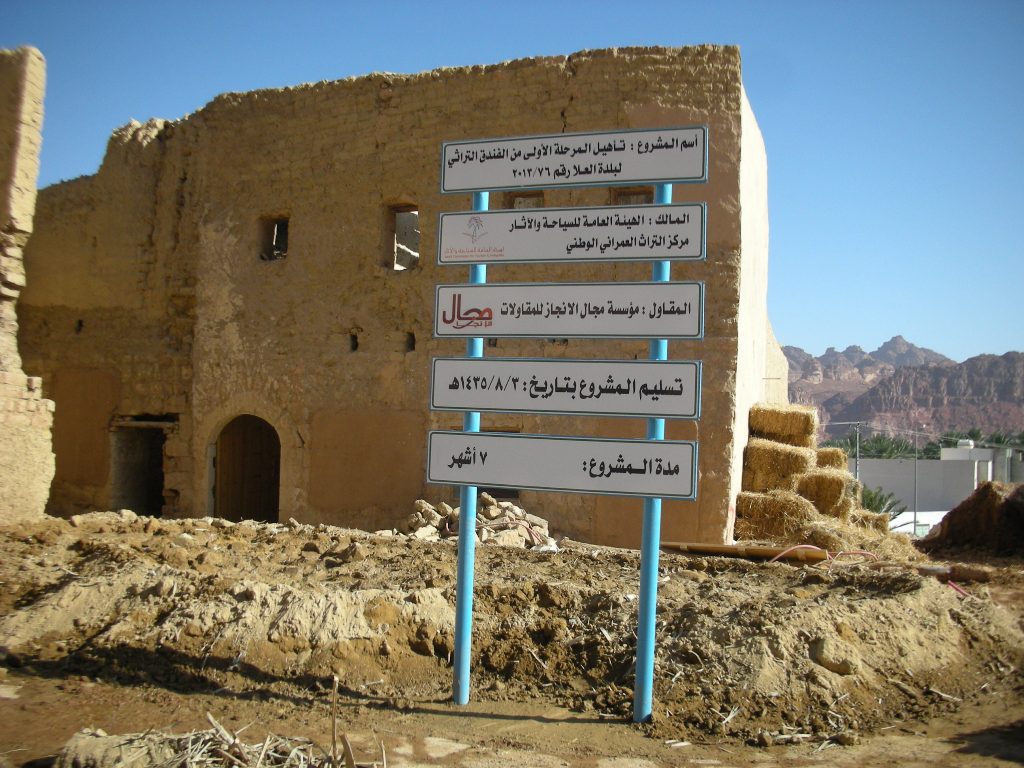
HEJAZ RAILWAY MUSEUM & HISTORY

Hejaz Railway Museum is a well-preserved place located in Madain Saleh. To our bad luck, it was closed. But inside the museum is history. It was built in the times of Ottoman Empire back in 1907. The major reason to build the station was to connect Constantinople with Madinah and Makkah so that the Muslims can easily perform Hajj. The other very critical reason was to bring economic and political integration of the Arab provinces into the Ottoman state and facilitate them with the transportation of military forces. And the point worth noting is by that time, the German empire was backing the Ottomans.

Like I wrote in the first chapter of ‘The Breezing Ula’ that pilgrims from Damascus used to perform pilgrimage by entering al-Ula’s ancient town and Syrian merchants used to sell supplies to the pilgrims. So I think there might have been a consideration by the Ottomans to propose a platform to connect the Muslims from the close neighborhood to perform Hajj with ease. But the then Emir and Sharif of Mecca, Hussain bin Ali, sensed some kind of threat through the railway connections as it provided the Ottomans an easy rout towards Hejaz, Asir and Yemen. After the fall of Ottoman Empire, the railway connection was abolished.
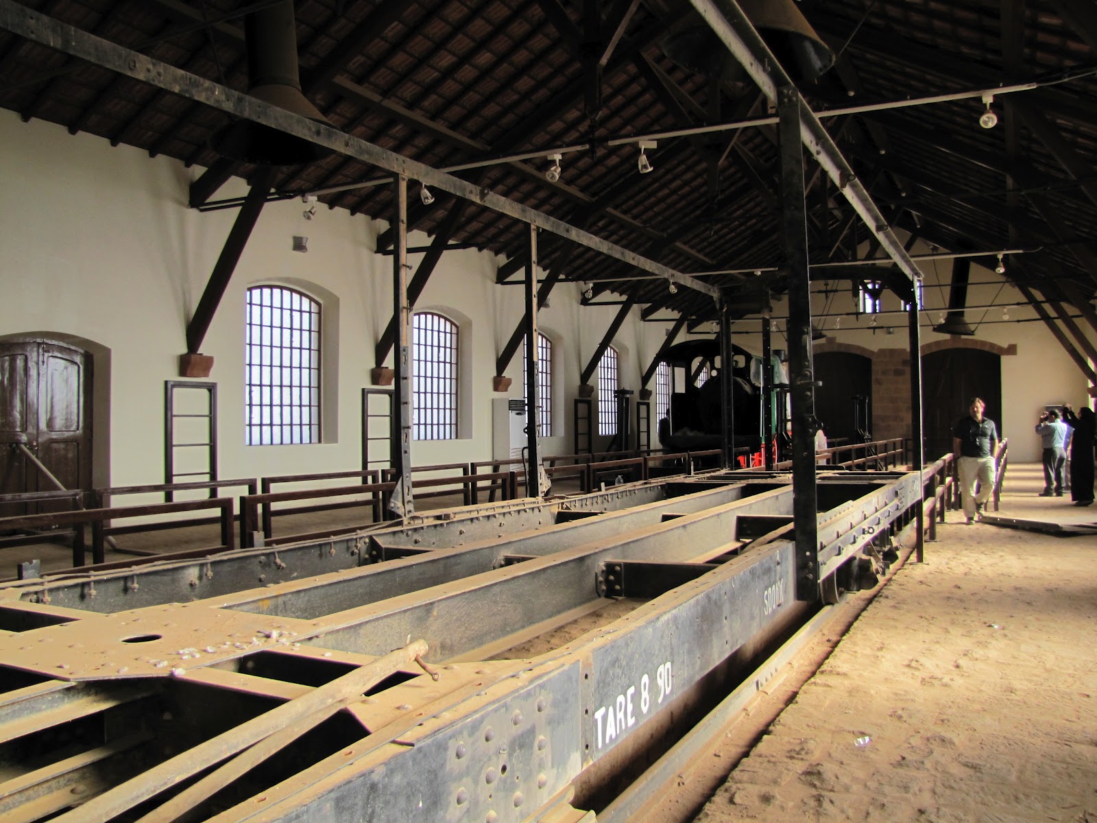
So that is the summarized story of this Railway Station. Anyhow the station has 16 buildings all built in the Ottoman Empire. They were used as accommodation and rest area for passengers, and a large railway workshop (with a restored WWI-era engine).
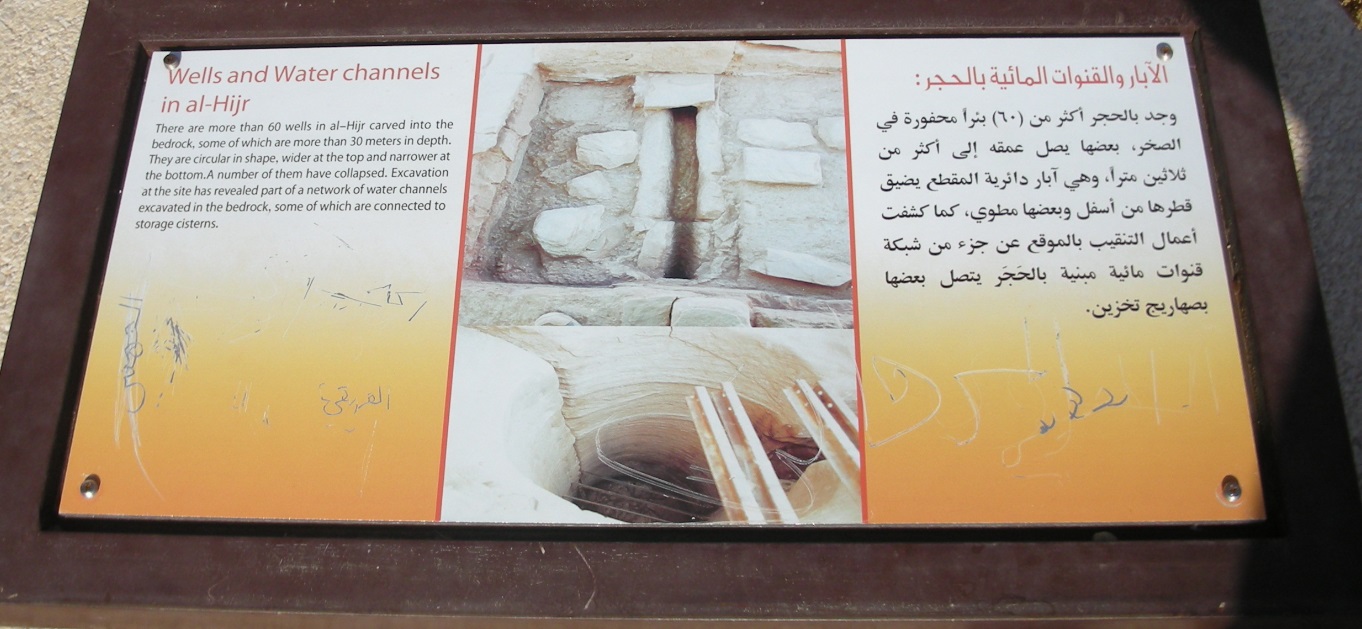
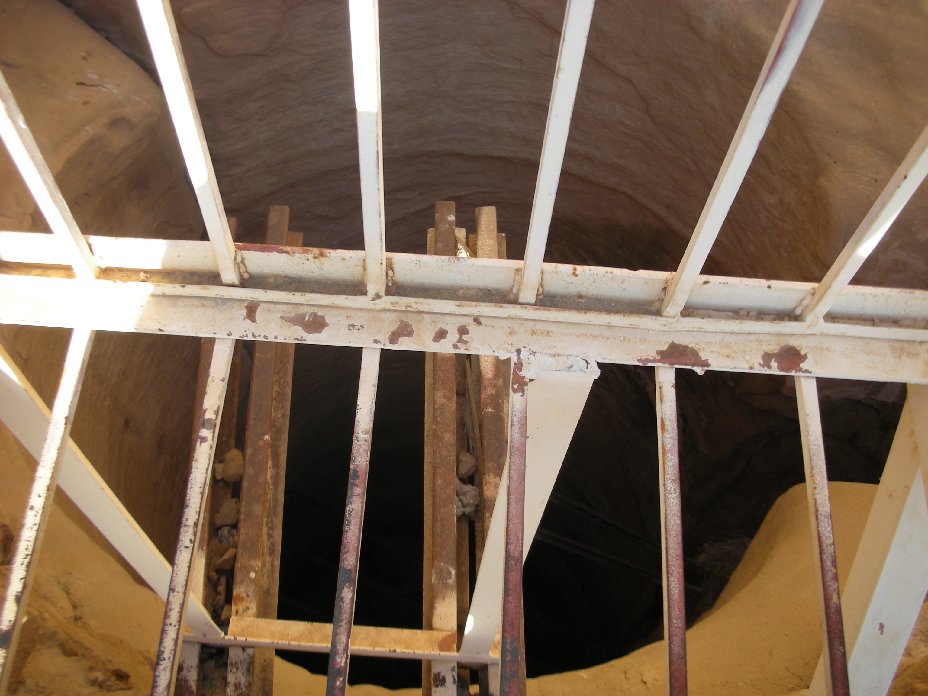
NABATEAN WELL
There are more than 60 water wells in Madain Saleh, some of them are more than 30 meters in depth. Many of them collapsed in different space of time. But the one officially is termed as Nabatean Well located in a very restricted area. The signboard clearly says that visitors are not allowed to trespass and violators are subjected to penalties. But that day, gate was open. We entered and saw that very messed well of Nabatean times. White fences are installed for the safety and taking the picture of the depth of well is at your own risk. Excavation teams have discovered a network of water channels and the work on it is under process.
Madain Saleh is under supervision of SCTA (Saudi Commission for Tourism and Antiquities) but to be precise and perfectly honest, my observation is that this World Heritage Site is in sorry state of any proper care. The place need a careful study of the implementations made for safety and security. The site is a massive national tourism treasure and can easily grab a huge no. of visitors and has a sharp contrast of attracting the foreigners due to its vast rich history and the abandoned culture and civilization.
SCTA must consider the following points which I am sure many visitors have noticed and are raising eyebrows over the site’s safety:
- 4×4 and other vehicles enter the site areas but don’t park in parking lots. Vehicles do enter the sites and sometimes due to extreme sandy surface, the vehicles go stuck in it.
- There is no guide to serve and inform you the history behind the sites, only information plates are installed, which is never enough.
- There is not a single security guard in a 13km-spread Madain Saleh site which has cost this world heritage site a depth nature of the beauty of its attraction towards the visitors.
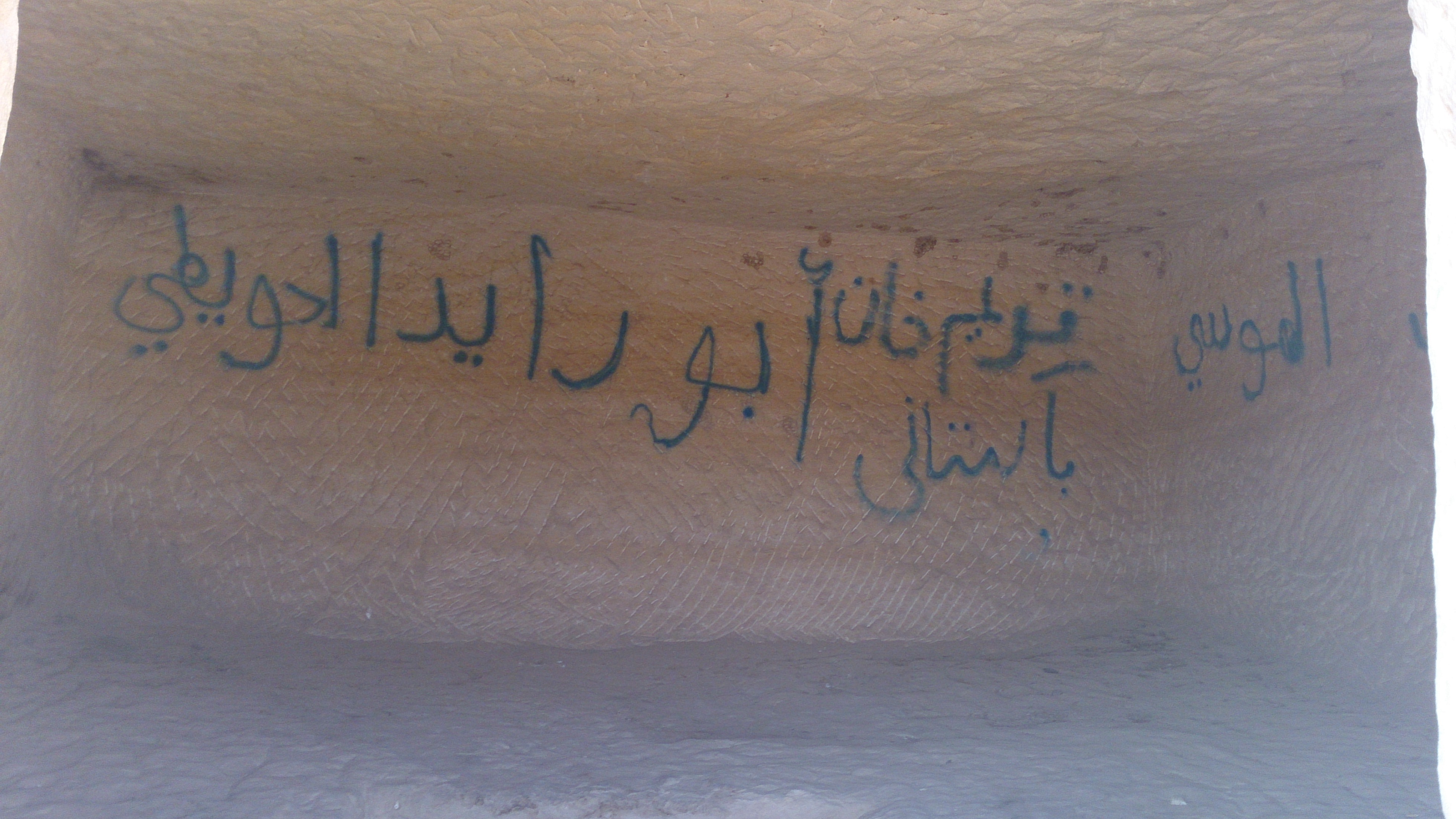
- Many nonsense visitors have marked some signs and words in their languages. They have sprayed some of the wall graves. Imagine the impact on foreigners and tourists touring from different parts of the world!!

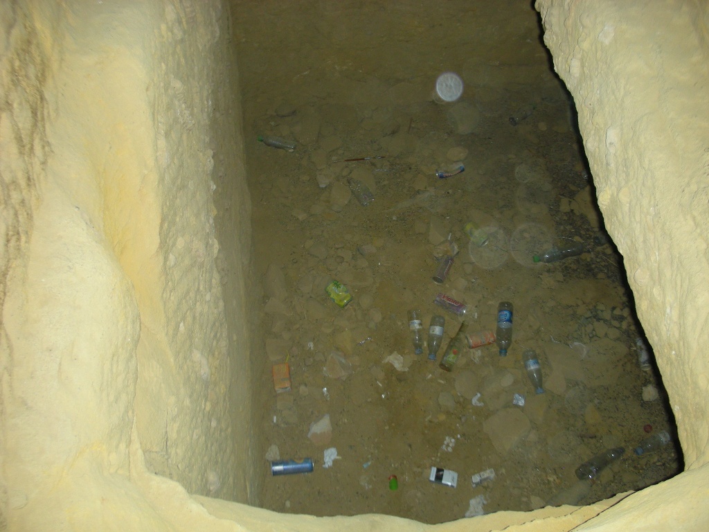
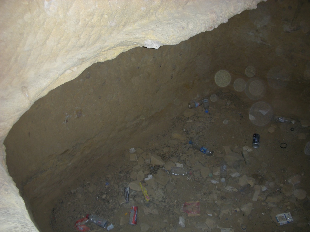
- Even more disaster is that you will find empty plastic water bottles, drink cans, packet of cigarette on many many tombs. Despicable!!!
No matter how disappointing the behavior of few visitors are but the blame should go the SCTA management who are hugely responsible of not taking steps to add Tour Guides and Security Guards to a UNESCO recognized World Heritage Site.
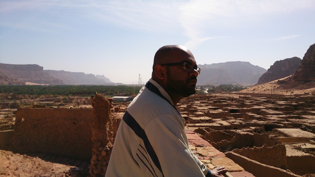
After a stay for an hour or two with most of the sites covered, we were satisfied enough to depart from that marvelous site. I can’t say if that is my final visit ever but surely I may visit after a long period of time. This was my third visit in past four months.
The Ula-tic journey didn’t end here. We musketeers had to march way back to look for that Umm Daraj which had became impossible due to lack of guidance en route. Our ribs tickled to see a noted old rock which is in shape of an elephant. We saw its sign board 5km near to Madain Saleh. So why not make a short tour of that particular place?
A very sandy route towards the rock and many tourists and visitors camping that site. Hanging our necks left and right to locate the spot and somehow our eyes caught a rock with a massive height with its shadow spreading almost a mile. We realized that we were looking that noted rock from its back and drove the car towards the front. It was a stunner!! Almost a 50-meter rock of elephant shape which is called Jabal Sakhrat al-Feel ‘Elephant Rock’.
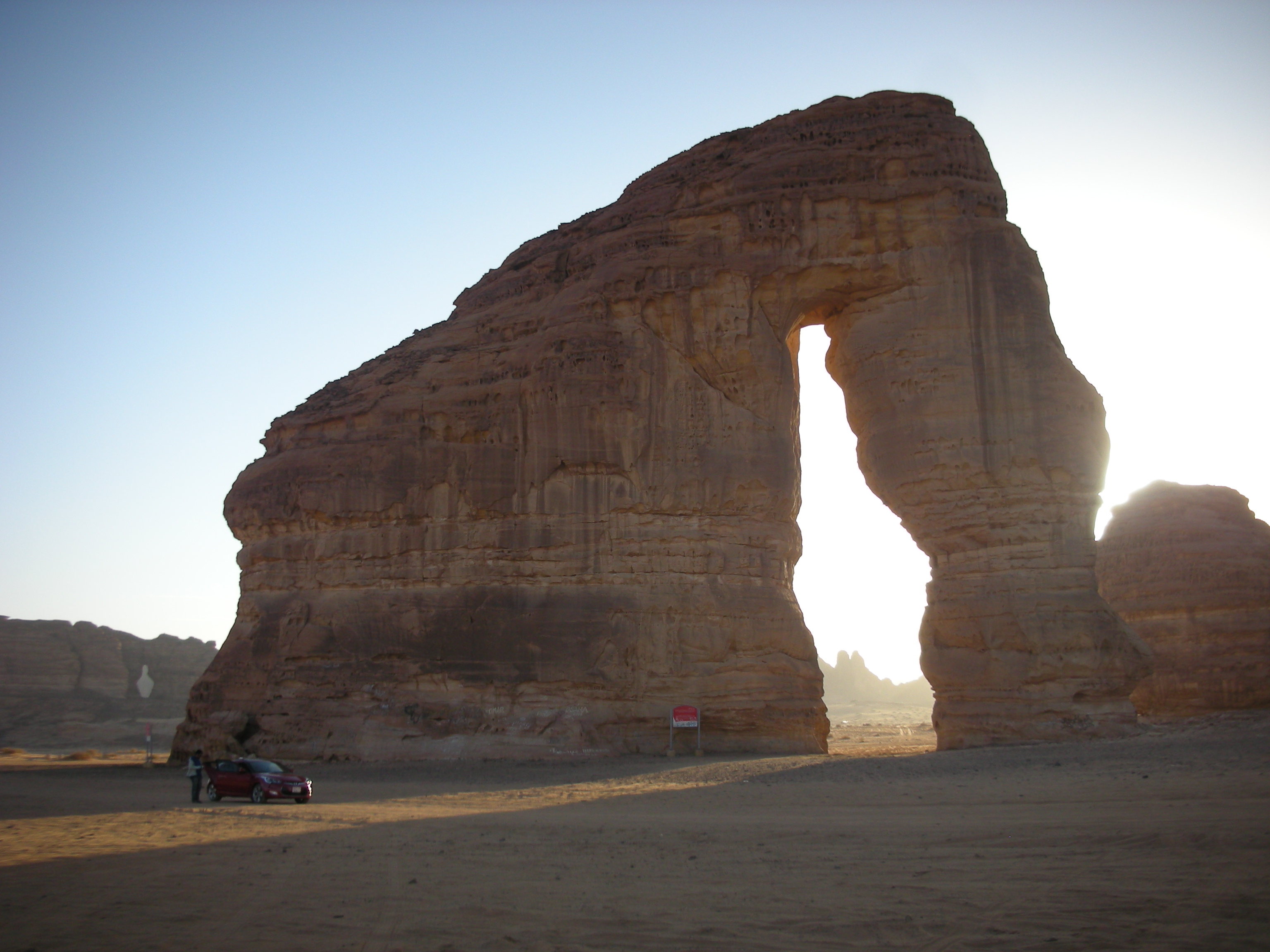
There is no specific history of this rock formation. People used to say that this rock was naturally furbished by massive sandstorms produced in last thousands of years. Once again the disappointment is that many visitors are marking some signs and wordings on this rock and destroying the look of its formation. We galloped to the distance for pictures and videos and after a 20-minute short stay, we left to locate Umm Daraj as final call.
Sun was setting, darkness was harking at unusual pace like always. At one of route, I sensed if the ‘Mother of Steps’ can be witnessed in one of small village located towards the mountains we thought if they were al-Harra. I took the risk, drove my car and paid the price. The car stuck in sand. With no street lights in the village and limited source of one-eye halogen in car, we were suppose to enjoy an FML epic. We collected some juniper tree skins and flat woods and lied above the sands parallel to the normal route towards a proper street. It worked and thanks to my musketeers.

Had a normal dinner in the restaurant with that same funny name ‘al-Mazaq’. Navigation on mobile was set and left al-Ula at 8pm. These 750 kilometers of distance were swiftly covered in nearly 5 hours of crazy but proper drive.
After crossing Yanbu beach, the police had their role of very strict checking to all the vehicles. Many of cars with group of boys were taken out and scanned them. I guess the inspection team were alerted by some alarm. Myself was fined for over speeding (most probably due to running on radar).
I am very thankful to my readers who read my travelling account composed in three different episodes. Hopefully I have brought some attention towards the travelers who are keen to march towards different tripping spots in this dry Kingdom. Also my words won’t stop ending without saying a proper thank-you to my fellow musketeers. Without them, this trip would have never brought any meaning of enjoyment we had everywhere altogether.
With all the excitements, fun and loads of explorations; we treasured a moment of unforgettable experience. This was my story. This was a story of three musketeers who framed a 2-day trip towards a whole bunch of amusement. A life temporarily settled in the Breezing Ula will be a memory to cherish for a long period of time.
SUBSCRIBE TO MY YOUTUBE CHANNEL AND WATCH MY TRAVEL VLOGS HERE
FOLLOW ‘THE DARK KNAIK’ ON OTHER SOCIAL PLATFORMS
TIKTOK https://www.tiktok.com/@thedarkknaik
FACEBOOK https://www.facebook.com/thedarkknaik
INSTAGRAM https://www.instagram.com/thedarkknaik/